UAE
Dubai Municipality launches e-system for providing comprehensive geospatial data and maps of Dubai
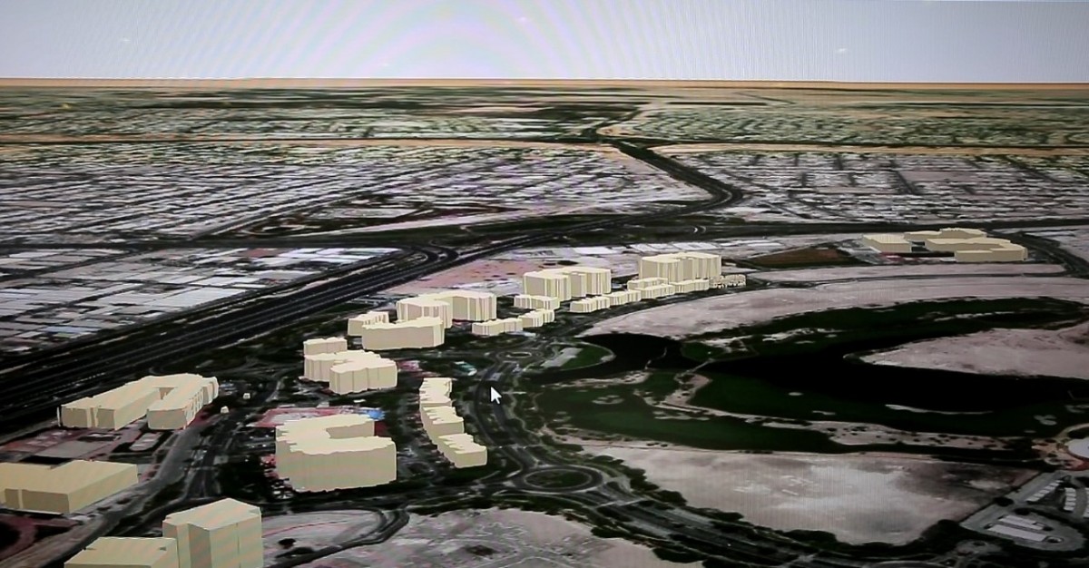
(WAM) — Dubai Municipality’s Geographic Information Systems, GIS, Centre has launched “Dubai Here”, an electronic system that provides access to geospatial data and maps of the emirate.
The new system features 2D and 3D maps of Dubai’s land plots, assets, landmarks, structures and infrastructure facilities, with details ranging from masterplans and interiors of buildings, including commercial and residential units, to external green areas, parks, trees, bridges, tunnels and service lines.
Accessible on a web browser or smart device, “Dubai Here” is designed to be easily updated. The system displays maps from a comprehensive geospatial database which all parties can contribute to and update. The e-system provides access to details of housing units, service units and networks and information on economic activity, the environment, health and population.
Dawoud Al Hajri, Director-General of Dubai Municipality, said, “Dubai Municipality is committed to providing high-quality services to customers by developing innovative technical solutions in accordance with the highest international standards. These services aim to help professionals in various fields utilise GIS technology in the decision-making process while also enhancing their overall user-experience.”
Al Hajri explained that geospatial data and maps are essential tools used for making decisions and completing projects in the areas of city planning, infrastructure, security and health, which contribute to providing smart services, promoting economic growth, anticipating the future and increasing the level of international competitiveness and leadership.
Al Hajri added that Dubai Municipality has expanded its GIS Centre in line with its vision to make Dubai a happy and sustainable city. The Centre aims to provide a “Digital Twin” of Dubai in the form of 2D and 3D maps of the emirate’s assets, landmarks and structures. This digital edition, enhanced with IoT technologies and linked to real-time information, provides all the information necessary for planning and managing the city and providing effective smart services.
To achieve this goal, the GIS Centre recently launched “GeoDubai”, an initiative that provides unique services and support to government, educational and private entities in the field of maps. GeoDubai provides a comprehensive and unified base map that provides the background detail necessary for all engineering, planning and development work in Dubai, including city planning conducted by the municipality or free zone authorities, zoning and identification of land plots, and planning and implementation of service networks. It enables authorities in Dubai to coordinate and cooperate to complete and update maps and information necessary to create Dubai’s “Digital Twin”.
Through GeoDubai, the GIS Center provides unique services to members of the Dubai Geospatial community including various kinds of maps, data, technical consultations, specialised training, software licenses, photography aerial using drones and geospatial survey of streets using a specialised vehicle.

Vodafone Oman Marks Fourth Anniversary With Approximately 17% Market Share

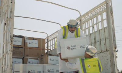
Sohar International Contributes OMR100,000 to Support Those Affected by Al Masarrat Weather Conditions

Liva Insurance Announces New CSR Initiative to Renovate Children’s Cancer Ward at Sultan Qaboos University Hospital

Real Estate Price Index in Oman Grows By 13.9%

Oil Surges More Than 2% as Supply Disruptions Mount

Ibri Industrial City Localises Two Projects Worth RO2M in 2025

VIDEO: Al Khamayil Oman Scales Up Production with New Rusail Facility

Cadillac Enhances Ramadan Ownership Value With Premium Benefits Package

CONNECT and OCEC Partnership Strengthens Oman’s Position as a Global Events Destination

Exclusive: Inside Oman’s Evolving MSME Finance Ecosystem – An Interview with Hussain Al Lawati, CEO, Development Bank

Power And Beyond: The Path To A Low-carbon Future

Al Mouj Muscat unveils Ghadeer Villas

Time to Buy Saudi Stocks? Some Investors Look at Dubai Instead

Renewables are booming, but not fast enough to cap greenhouse emissions

Hospitality Industry in Oman Estimated 90% Growth in 2022

Retail Abu Dhabi’s ‘Unbox Amazing’ generates sales of more than AED 2 billion in participating stores

Saudis Sign Deals From Energy to Metals in Bid to Salvage Forum

Saudi Arabia’s Gold Miner Plans to Be a Global Top-20 Supplier

Technology to drive Sultanate’s downstream industry

Digitization and Logistics Service Providers Can Help SMEs Make the Most of Peak Season Retail Trends

VIDEO: Robert MacLean on how NHI is Shaping Oman’s Next Generation of Hospitality Leaders

The Future of Oman: Decoding The Sultanate of Oman’s Strategic Promotional Nation Brand

EXCLUSIVE: AI, Robotics & Wearable Sensors are Changing the Lives of Dementia Patients

EXCLUSIVE: Talking Renewable Projects & Sustainability in Oman and Beyond with Vipul Tuli

VIDEO: Eng. Salim Al Thuhli, CEO, Khazaen Economic City on Investment Opportunities

H.E. Salim Al Aufi, Minister of Energy & Minerals talks about Oman’s Green Hydrogen Goals

VIDEO: Talking Latest Developments in Aircraft Ground Guidance & More at Oman Airports

VIDEO: Dr. Firas Al-Abduwani Discusses Green Hydrogen, Potential Regions for Development & Creating a Green Ecosystem

VIDEO: Discussing The Future of Green Hydrogen in Oman with H.E. Salim Al Aufi

Celebrating Infoline’s Remarkable 20-Year Journey
-

 Dossier1 month ago
Dossier, 2026
-

 OER Magazines1 month ago
OER, February 26
-
 Banking & Finance1 month ago
Sohar International and Sohar Islamic Supports Over 100 Families in Al Wusta Governorate Through Its ‘Sohar Al Attaa’ Initiative
-

 Banking & Finance1 month ago
National Finance Unveils Exclusive Ramadan Offers on Auto Financing
-
 Economy1 month ago
Middle East Tensions Heighten Risks to Strait of Hormuz, Raising Uncertainty for Global Oil Markets
-

 Economy1 month ago
Analysis: Oman-India CEPA Opens Path to Deeper Trade Investment and Growth
-

 Economy1 month ago
ANALYSIS: Oil Near Seven-Month Highs Amid US, Iran Tensions
-

 Education2 months ago
Jebel View International School to Launch in Muscat in September 2026 & Now Open to Visit